The Dholera master plan is the long-term blueprint for the Dholera Special Investment Region, a greenfield smart city under the Delhi-Mumbai Industrial Corridor covering a reported area of about 920 sq km. It is built through Town Planning (TP) schemes, a land pooling method that turns raw land into serviced final plots. TP2's roughly 22.5 sq km Activation Area is the most developed zone today. This guide explains TP schemes, land pooling and zoning in plain terms.
- Reported area about 920 sq km, planned in phases toward 2040
- Six TP schemes (TP1 to TP6); the ~22.5 sq km Activation Area sits in TP2
- Completed TP schemes issue final plots with NA status and zoning; still verify each plot
The Dholera master plan in context
Dholera is not an ordinary township, it is a planned Special Investment Region. The Dholera SIR master plan is the long-term blueprint that turns a largely rural coastal area into a greenfield smart city under the Delhi-Mumbai Industrial Corridor. It is reported to cover about 920 sq km, making it one of India's largest planned urban projects, developed in phases with the horizon reported to extend toward 2040 (Vallabbh Estates). The plan lays out how land, industry, housing, utilities and transport fit together before building begins, which is what "planned smart city" really means.
Two connectivity spines run through that plan: the Ahmedabad-Dholera Expressway for road, and the planned rail and metro / MRTS links. But the core of the master plan on the ground is delivered through Town Planning schemes.
What a TP scheme is
A Town Planning scheme, or TP scheme, is a land pooling and readjustment mechanism under Gujarat's Town Planning and Urban Development Act, 1976 (Nestoria Group). In simple terms, the authority pools the scattered private landholdings in an area, lays out a planned grid of roads and utilities, and then returns reconstituted plots to the original owners in an organised layout. Landowners give up a share of area toward public infrastructure and in return receive serviced, higher-value final plots. It is the standard Gujarat method for building orderly cities without large-scale forced acquisition.
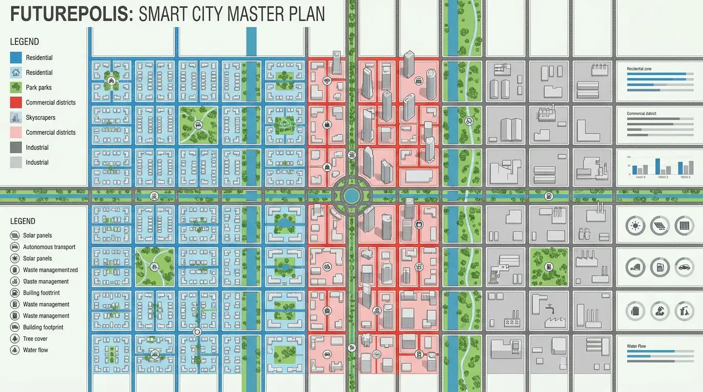
TP1 to TP6
Dholera SIR is planned across six Town Planning schemes, TP1 through TP6, each covering a defined geographic area and development purpose (7 Oak Developers). Reported roles include:
TP1 supports early residential and knowledge or IT uses alongside green and recreational areas, covering villages in that corridor. TP2 is the Activation Area, Dholera's most developed zone and home to early industrial anchors. TP3 and TP4 extend the planned mix of residential, commercial and industrial uses as development moves outward. TP5 is reported for heavy industry and warehousing, and TP6 for green and renewable energy uses such as solar. Roles and boundaries are as reported by planning summaries; always confirm the current designation for a specific parcel against official DSIRDA records.
The Activation Area
If Dholera has a beating heart today, it is the Activation Area. This is the first phase built to demonstrate the city, reported at about 22.5 sq km and located within TP2 (Gujarat Infrastructure Development Board). It is sometimes described as the Early Harvest or priority development zone. Reported infrastructure here includes wide roads, Narmada-sourced water supply, underground power distribution, a gas network and ICT ducts, with figures such as roughly 72 km of internal roads and services cited for the zone (Smart Dholera). Major industrial investment, including semiconductor manufacturing, is reported within this zone, which is why it anchors most current activity.
Land pooling and final plots
The practical payoff of a completed TP scheme is the final plot. Once land pooling and reconstitution are finished, private parcels are reissued as final plots with defined boundaries and, importantly, non-agricultural (NA) status and assigned zoning. Reports indicate that the earlier schemes have completed their pooling and reconstitution phases and that plots in them are issued as NA final plots with specified use and development rights (Dholera Acres). That is a meaningful legal step up from raw agricultural land, but it does not remove the buyer's duty to check the specific plot.
Zoning and land use
The master plan assigns every area a land use: residential, commercial, industrial, knowledge or IT, recreational and green, and renewable energy, all knit together by planned roads, clean-energy supply and smart utilities (Vallabbh Estates). Zoning matters because it governs what you can build on a plot and shapes its value. A residential final plot, an industrial parcel and a green-zone plot are not interchangeable, so the zone attached to a specific final plot is one of the first things to confirm.
What it means for buyers
The master plan and TP structure are what make Dholera a genuinely planned city rather than scattered land sales, and that is a real strength. But planning on paper is not the same as a clean purchase. Before buying any Dholera plot, verify the final plot number and its TP scheme, the Gujarat RERA registration of the specific project, clear and marketable title, the non-agricultural status, and the assigned zoning, and get pricing and payment terms in writing. Nothing here is investment advice, and returns are never guaranteed. To compare builders neutrally, see our top Dholera developers guide, and to understand access, see the expressway and distance guides. You can also start with our Dholera tools.
Master plan at a glance
Region: Dholera SIR, reported about 920 sq km · Framework: Delhi-Mumbai Industrial Corridor greenfield smart city · Delivery: six TP schemes (TP1-TP6) via land pooling · Activation Area: about 22.5 sq km in TP2 · Final plots: NA status and zoning in completed schemes · Horizon: phased, reported toward 2040.
Browse the developer directory →Frequently asked questions
What is the Dholera master plan?
It is the long-term development blueprint for the Dholera SIR, a greenfield smart city under the Delhi-Mumbai Industrial Corridor, covering a reported area of about 920 sq km and planned in phases with development reported toward 2040, divided into TP schemes and land-use zones.
What is a TP scheme in Dholera?
A Town Planning scheme is a land pooling and readjustment mechanism under Gujarat's Town Planning and Urban Development Act, 1976. The authority pools land, builds trunk infrastructure, and returns reconstituted final plots to owners. Dholera is planned across TP1 to TP6.
What is the Activation Area?
It is Dholera's first and most developed zone, reported at about 22.5 sq km within TP2, with trunk infrastructure such as wide roads, water, underground power and ICT ducts, and early industrial anchors.
What does land pooling mean for a plot buyer?
In a completed TP scheme, private parcels are reissued as final plots with defined boundaries, non-agricultural status and zoning. You should still independently verify the final plot number, RERA registration, clear title and NA status for the specific plot.
Which TP scheme is most developed?
TP2, which contains the Activation Area, is reported as the most developed today, with completed trunk infrastructure and major industrial investment. Confirm the current status of any specific plot against official DSIRDA records.